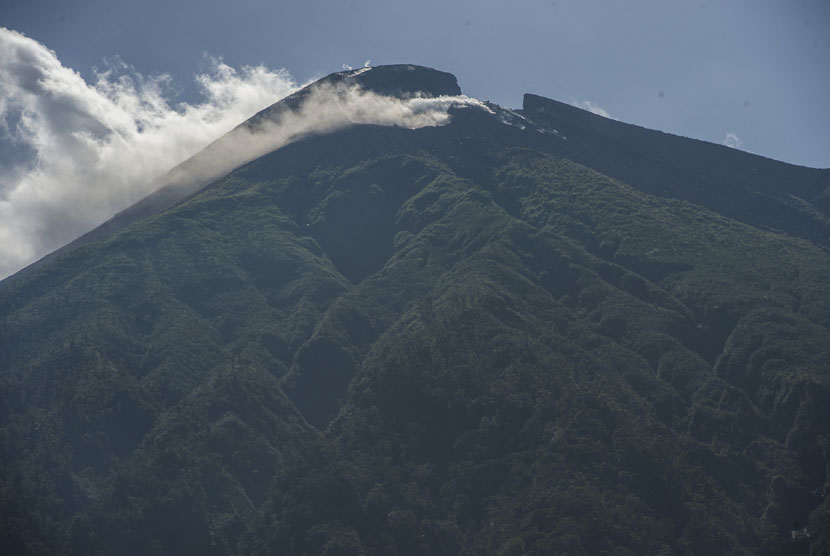
REPUBLIKA.CO.ID, TERNATE -- The Center for Volcanology and Geological Disaster Mitigation (PVMBG) stated that Mount Gamalama in Ternate, North Maluku (Malut), emitted smoke and recorded 14 volcanic earthquakes with an amplitude of 4-12 mm. Head of the Center for Volcanology and Geological Disaster Mitigation Hendra Gunawan said Mount Gamalama had experienced a volcanic earthquake since Thursday (2/22/2024).
He said that the volcanic earthquake showed an increase in pressure in the body of Mount Gamalama due to increased magmatic activity, but until now surface earthquakes have not been recorded. According to him, from Thursday (22/2/2024) to Friday, Mount Gamalama recorded 3 gusting earthquakes, 4 deep volcanic earthquakes, 2 local tectonic earthquakes, and 5 distant tectonic earthquakes. The activity of the crater blowing is observed thick white crater smoke with a height of 100-400 meters, with a weak wind towards the north.
PVMBG states that on February 1-22, 2024, 26 gusting earthquakes, 2 harmonic earthquakes, 1 tornillo earthquake, 1 shallow volcanic earthquake, 34 deep volcanic earthquakes, 57 local tectonic earthquakes, 181 distant tectonic earthquakes, and 2 tremor earthquakes were recorded. The crater's blowing activity is observed blowing thin to moderate white crater smoke with a height of 10-100 meters. Winds are weak to the north, northeast, east, southeast, south, southwest, and west.
In general the activity of Mount Gamalama from January 1 to February 23, 2024 tends to be fluctuating and is still dominated by deep volcanic earthquakes, local tectonic earthquakes, and distant tectonic earthquakes related to regional tectonic activity around the Haimahera archipelago. According to Hendra, the most likely potential hazard is a phreatic eruption with the threat of material ejection from the main crater hitting the region within a radius of 1.5 km from the eruption center. Thin ash showers can occur with distance and intensity depending on the direction and speed of the wind.
Based on the results of observations, analysis of visual and instrumental data, the activity level of Mount Gamalama is still at Level II (Alert). In connection with the activity level of Mount Gamalama at Level II (Alert), it is recommended that people around Mount Gamalama and visitors/tourists not to do activities within a 1.5 km radius of the main crater at the summit of Mount Gamalama.


