
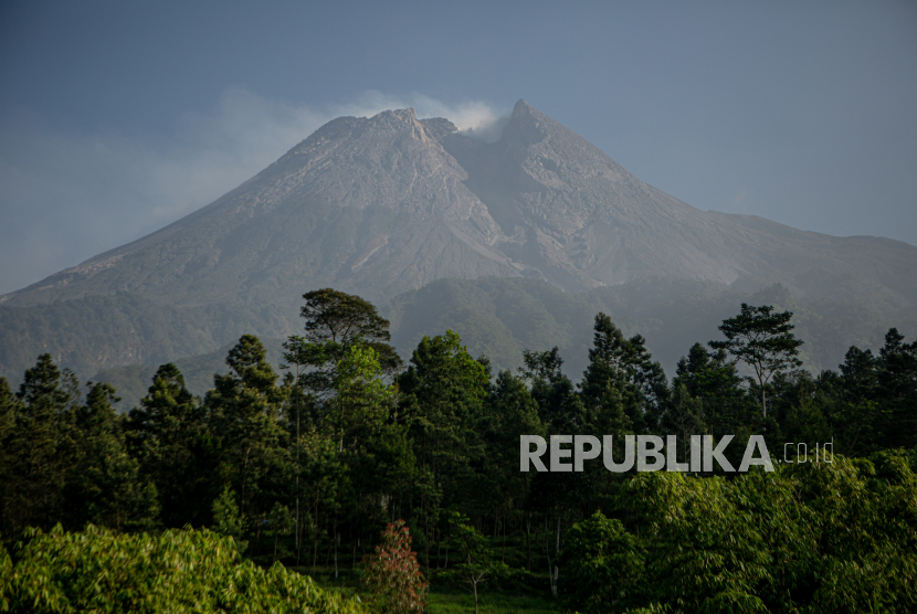
REPUBLIKA.CO.ID, JAKARTA— The Geological Disaster Technology Research and Development Board (BPPTKG) stated that the eruption of Mount Merapi, located on the border of Central Java and Yogyakarta, has not shown signs of ending.
The head of the BPPTKG, Agus Budi Santoso, said the eruption was still going on at a fairly high intensity with the incidence of falls reaching hundreds of times per day.
“This condition does not seem to end in the near future because monitoring data from seismic and deformation methods indicate that magma supply is still ongoing,” the report quoted via the official Instagram account of BPPTKG in Jakarta on Friday (5/1/2023) said.
On January 4, 2024, Mount Merapi had entered the eruption phase for three years. The active volcano, which has an altitude of 2,968 meters above sea level, is still in Level III or Alert status.
Agus explained the potential danger caused by the eruption from the fallout heat cloud that can occur to rivers in the southeast to southwest sectors with a maximum glide distance of 7 kilometers.
According to him, people can still function normally outside of potential danger. The area of potential danger is only about in the rivers upstream of Mount Merapi.
Especially for people who work in the river, such as sand miners and others, BPPTKG urges to be aware of lava and hot clouds falling.
“The high rainfall that occurs at the top of Mount Merapi can disrupt the stability of the lava dome and create fall heat clouds, as well as create lava in the rivers upstream of Mount Merapi,” Agus said.
Earlier, the Center for Volcanology and Geological Disaster Mitigation (PVMBG) reported Mount Merapi spewed a 1,800 meter fall heat cloud leading southwest of Kali Bebeng.
PVMBG chief Hendra Gunawan said the fall heat cloud occurred at 18.18 pm with a maximum amplitude of 19 millimeters with a duration of 155.56 seconds.
“People are urged to stay away from the recommended danger areas,” Hendra said in a statement received in Jakarta on Thursday.
Since November 5, 2020 until now, Mount Merapi, located on the border of Central Java and Yogyakarta, occupies the status of disaster level III or alert because volcanic activity is still quite high in the form of effusive eruptions.
PVMBG stated that the current potential danger in the form of lava falls and hot clouds in the south-southwest sector includes Boyong River for a maximum of 5 kilometers, Bedog River, Krasak, Bebeng for a maximum of 7 kilometers.
In the southeastern sector it includes the Woro River for a maximum of 3 kilometers and the Gendol River 5 kilometers. Meanwhile, the ejection of volcanic material during an explosive eruption can reach a radius of 3 kilometers from the summit.
PVMBG appeals to the public not to carry out any activities in the area of potential danger of Mount Merapi.
