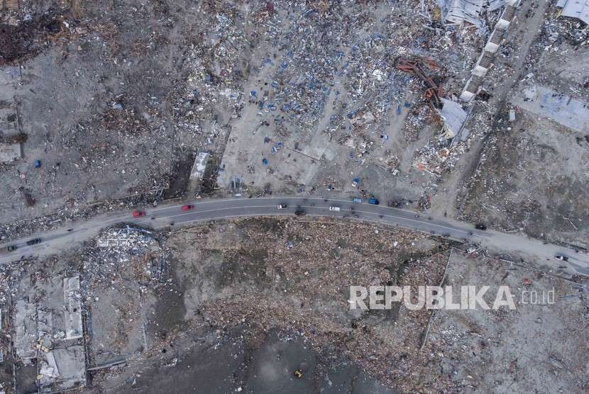
REPUBLIKA.CO.ID, JAKARTA -- The recent deadly earthquake and tsunami that hit Palu City, Central Sulawesi, and the districts of Donggala and Sigi damaged at least 5,146 buildings. The data came from a collaborative work of Indonesian and Thai scientists.
The preliminary result was calculated by the National Institute of Aeronautics and Space (LAPAN), Bandung Institute of Technology, and Asian Institute of Technology-Thailand's joint team members by referring to the Pleiades Satellite imagery.
According to the press statement of LAPAN's disaster response team, made available to Antara here on Wednesday, the data used for calculating the satellite imagery had yet to cover all disaster zones in the districts of Palu and Donggala.
Satellite data was collected by LAPAN's ground stations in Parepare, some 155 kilometers (km) away from North of Makassar, South Sulawesi Province, by using data of the Pleiades Satellite imagery available on July 6, 2018, before the earthquake and tsunami struck.
The available data was then compared to that of the International Disasters Charter that the joint team members had gathered on Sept 30, or two days after the catastrophe. By applying a visual interpretation method, the scientists compared the two data to calculate both damaged and likely damaged buildings.
The result indicated that 418 buildings were damaged in Donggala District and 2,403 buildings in the city of Palu, while 315 buildings in Donggala and 2,010 in Palu were categorized as "likely damaged."
The number of buildings, categorized as "damaged and likely damaged," is expected to increase after all necessary data of the satellite imagery, covering all disaster areas, can be comprehensively calculated.
Of 5,146 damaged and likely damaged buildings, 1,045 belonged to the Balaroa housing complex that had been swallowed up by the earth below when the earthquake and tsunami shook Palu and some other parts of Central Sulawesi on Sept 28.
The width of the Balaroa disaster zone covers 47.8 hectares of land. Palu suffered the worst impact of the strong earthquake and tsunami.
The National Disaster Mitigation Agency recorded that the catastrophe had killed at least 1,407 people and displaced thousands of others. In response to this catastrophe, President Joko Widodo had expressed his condolences to those affected by the earthquake and tsunami.
Due to a large number of rotting corpses, the authorities and humanitarian workers have decided to bury them in mass graves.


