

REPUBLIKA.CO.ID, LUMAJANG— Mount Semeru, located on the border of Lumajang and Malang Regency, East Java, erupted by spewing volcanic ash up to one kilometer above Mahameru peak on Tuesday (9/4/2024).
According to the report of the Semeru Mountain Observation Post officer, the highest mountain eruption on Java Island was recorded on Tuesday three times until 15.00 pm, namely at 6:17pm, then 7:51pm, and at 10:34pm.
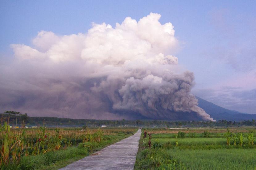
“There was an eruption of Mount Semeru on Tuesday, April 9, 2024 at 6:17pm with an ash column height observed about 1,000 meters above the summit,” Mount Semeru Observation Post Officer Ghufron Alwi said in a written report in Lumajang.
According to him, the observed ash column was white to gray with moderate to thick intensity towards the north and northeast. The eruption was recorded on a seismograph with a maximum amplitude of 20 mm and a duration of 98 seconds.
Then at 7:51pm there was another eruption with the height of the ash column observed about 1,000 meters above the summit or about 4,676 meters above sea level (MDPL).
“The observed ash column is gray in color with a thick intensity towards the north and northeast. The eruption was recorded on a seismograph with a maximum amplitude of 22 mm and a duration of 110 seconds,” he said.
The eruption of Mount Semeru occurred again at 10:34pm and the visual of the eruption was not observed, but the eruption was recorded on the seismograph with a maximum amplitude of 23 mm and a duration of 114 seconds.
Mount Semeru is still on Alert or Level III status, so the Center for Volcanology and Geological Disaster Mitigation (PVMBG) has issued a recommendation that people be prohibited from any activity in the southeastern sector, along Besuk Kobokan 13 km from the summit (eruption center).
Outside this distance, people are asked not to do activities at a distance of 500 meters from the river bank (river border) along Besuk Kobokan because of the potential for expanding hot clouds and lava flows up to 17 km from the summit.
People should not operate within a radius of five km from the crater/peak of Mount Semeru because it is prone to the danger of rock (incandescent material) ejection.
The public is also urged to be aware of the potential for hot clouds, lava falls, and lava flows along streams whose waters flow upstream at the top of Mount Semeru, especially along Besuk Kobokan, Besuk Bang, Besuk Kembar, and Besuk Sat as well as the potential for lava in small rivers that are tributaries of Besuk Kobokan.
