REPUBLIKA.CO.ID, JAKARTA -- Volcanic ash from the erupting Mount Agung in Bali could drift towards the neighboring East Java Province due to the passing tropical cyclone Cempaka, National Meteorology Climatology and Geophysics Agency BMKG stated on Tuesday.
"The eye of the cyclone will drag the volcanic ash, which was heading toward the east-southeast, to the south-southwest direction," Head of BMKG Dwikorita Karnawati noted here on Tuesday.
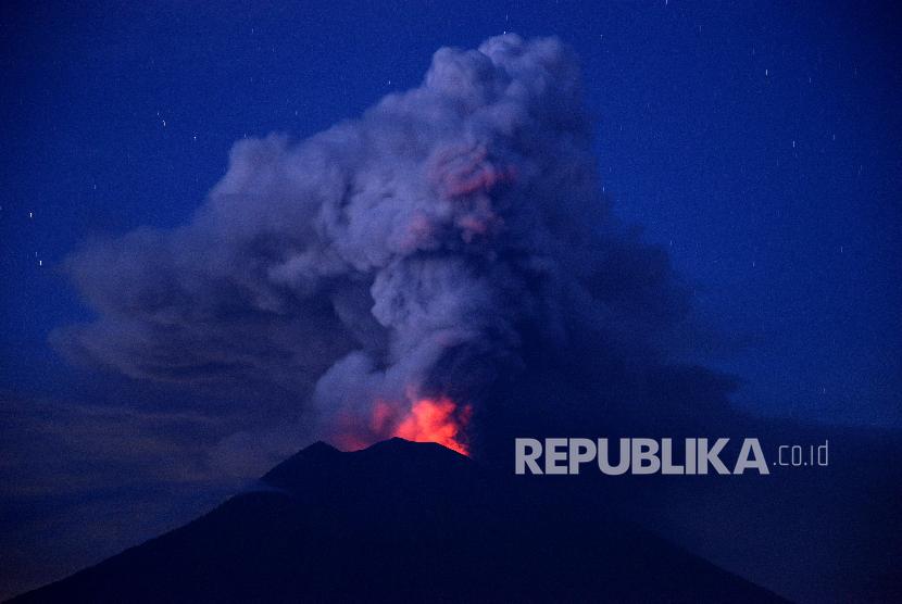
As a result, Bali and some parts of East Java Province, particularly Banyuwangi District, could be affected by the volcanic ash from Mount Agung.
The tropical cyclone Cempaka is currently moving south of East Java Province over the Indian Ocean.
The cyclone is eastbound and forecast to turn south within 24 hours, she remarked.
The cyclone brought torrential rains along with thunderstorms and strong winds, capable of reaching 20 knots, and caused high waves in the Indian Ocean and Sunda Strait, she pointed out.
The authority identified that the tropical cyclone Cempaka was formed from tropical cyclone 95S seed on Monday at 7 p.m. local time.
The 95S seed was first spotted at 9.6 degrees Southern Latitude and 109.4 degrees Eastern Longitude, or around 240 kilometers (km) southwest of Cilacap District, Central Java Province.
Meanwhile, the National Disaster Mitigation Agency (BNPB) has warned of the threat of cold lava flow from Mount Agung since rainy season has started in Bali.
The authority has urged people in Bali to avoid any activities near rivers close to Mount Agung.
"Cold lava flows are expected to increase due to the rise in intensity of the rain," Head of the Data and Information Center of BNPB Sutopo Purwo Nugroho stated on Monday.
Cold lava flow is a type of mudflow or debris flow comprising volcanic materials, rocky debris, and water.
The destructive materials flow down from a volcano along a river valley, destroying all structures in their path.
The government has set an exclusion zone within a 10-km radius of Mount Agung's peak.
The 3,142-meter-high volcano has been rumbling since August 2017.
On Nov 21, Mount Agung erupted, releasing volcanic ash and smoke 700 meters high from the crater at 5:05 p.m. local time.
At least 445 flights have been canceled due to the eruption of Mount Agung in Bali, thereby affecting the travel plans of some 89 thousand passengers.