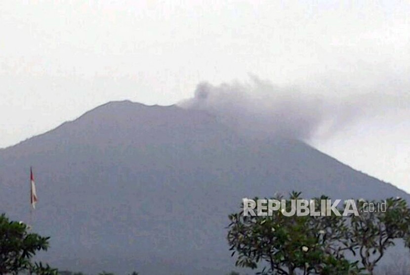
REPUBLIKA.CO.ID, AMLAPURA -- The Energy and Mineral Resources Ministry's Volcanology and Geological Hazard Mitigation Center (PVMBG) here on Friday deployed a drone over Mount Agung's crater to monitor its volcanic activity.
"The drone has monitored the crater since Thursday (Nov 23), and we have received some visual updates on the volcano while at the same time detected the levels of gases released from the caldera," an official Umar Rosadi noted in Amlapura, Karangasem District, Friday.
Equipped with a multi-gas sensor, the Ai450 drone was deployed to detect the levels of sulphur dioxide (SO2) and hydrogen dioxide (H2S) released from the crater following the eruption on Tuesday.
"This time, we are focusing on detecting the levels of the two gases -- SO2 and H2S -- after the volcano had a phreatic explosion on Nov 21," Rosadi remarked.
During the monitoring process, the drone's flight was disrupted by rains, and as a result, the operators had to delay the operation.
A day after the eruption, dozens of volunteers of the Bali Red Cross distributed three thousand masks to the people in Karangasem District in order to anticipate the impact of the volcanic ash.
Anticipate volcanic ash
The National Disaster Mitigation Agency (BNPB) has called on the locals and tourists to take precautionary measures against the impacts of the eruption, such as the volcanic ash.
"Hikers, tourists, and locals staying on the foothills of Mount Agung should not approach any disaster-prone areas," BNPB spokesperson Sutopo Purwo Nugroho remarked, Tuesday.
The disaster-prone areas cover all places inside and nearby the crater, within a radius of six kilometers (km), as well as within a 7.5-km radius to the north, northeast, southeast, south, west, and southwest of the volcano.
Nugroho noted that the authority can expand the disaster-prone areas based on the updates and evaluations of Mount Agung.
When the volcano erupted, some 29,245 villagers were evacuated to 278 camps. Hence, the BNPB will continue to maintain coordination with other stakeholders, such as the PVMBG and the Bali Disaster Mitigation Agency.
According to Nugroho, the PVMBG is still reviewing the status of the volcano. In October, the Meteorology, Climatology and Geophysics Agency downgraded the alert status of Mount Agung from the highest warning level IV to the second-highest level III.
During the eruption, Mount Agung had recorded a non-harmonic tremor measuring an amplitude of two millimeters for 36 seconds and two volcanic shocks of five to six millimeters' amplitude for eight to 26 seconds.
"After the eruption, we urge everyone to stay calm and follow the instructions issued by the PVMBG," he reiterated.